2017
SX4358 : Crossing the Tamar Bridge
taken 6 years ago, near to Saltash, Cornwall, England
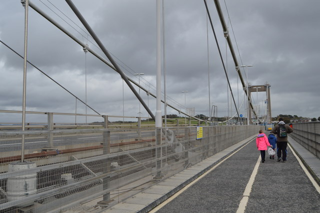
Crossing the Tamar Bridge
The Tamar Bridge is a road bridge at Saltash and Plymouth in southwest England carrying traffic between Cornwall and Devon over the River Tamar. It is adjacent to the Royal Albert Bridge.
When it opened in 1961, the Tamar Bridge was the longest suspension bridge in the United Kingdom. In 2001 it became the world's first suspension bridge to be widened (from three to five lanes) using cantilevers.
Construction of the Tamar Bridge began in July 1959. Before the Tamar Bridge was opened, most travellers between Saltash (on the Cornish side) and the Devon city of Plymouth used ferries. The Tamar Bridge carries approximately 40,000 vehicles every day. It is co-owned by Plymouth City Council and Cornwall Council. A toll of £1.50 per car is charged when driving from Cornwall into Devon if paid in cash. Motorcycles do not have to pay.
Wikipedia: Link
See other images of Tamar Bridge
 Map © Crown Copyright")
TIP: Click the map for more Large scale mapping
- Grid Square
- SX4358, 705 images (more nearby 🔍)
- Photographer
- N Chadwick (more nearby)
- Date Taken
- Sunday, 22 October, 2017 (more nearby)
- Submitted
- Monday, 12 February, 2018
- Subject Location
-
OSGB36:
 SX 4345 5881 [10m precision]
WGS84: 50:24.4951N 4:12.2706W - Camera Location
-
OSGB36: SX 4342 5881
- View Direction
- East-southeast (about 112 degrees)