SX4458 : St Budeaux Ferry Road Station
taken 6 years ago, near to St Budeaux, Plymouth, England
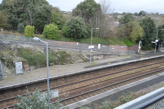
St Budeaux Ferry Road station is a suburban railway station in St Budeaux, Plymouth. It is served by Great Western Railway services during the rush hour only. The vast majority of services pass through non-stop due to the proximity of Victoria Road station - the entrances to the two stations are directly opposite each other. To the west the line singles and crosses into Cornwall on the Royal Albert Bridge. The station opened in 1904.
The Cornish Main Line is a railway line in Cornwall. It runs from Penzance to Plymouth, crossing from Cornwall into Devon over the famous Royal Albert Bridge at Saltash.
It directly serves Truro, St Austell, Bodmin (by a Parkway station), and Liskeard, and it forms the backbone for rail services in Cornwall, as well as providing a direct line to London, Birmingham, Leeds and Edinburgh. There are branches off the main line serving St Ives, Falmouth, Newquay, and Looe.
It is the southernmost railway line in the United Kingdom, and the westernmost in England. The line was fully completed in 1867.
 Map © Crown Copyright")
- Grid Square
- SX4458, 87 images (more nearby 🔍)
- Photographer
- N Chadwick (more nearby)
- Date Taken
- Sunday, 22 October, 2017 (more nearby)
- Submitted
- Thursday, 22 February, 2018
- Subject Location
-
OSGB36:
 SX 4469 5800 [10m precision]
WGS84: 50:24.0781N 4:11.2042W - Camera Location
-
OSGB36: SX 4464 5803
- View Direction
- East-southeast (about 112 degrees)