2018
SJ0829 : Old field boundary
taken 6 years ago, 4 km WSW of Tyn-y-Ffridd, Powys, Wales
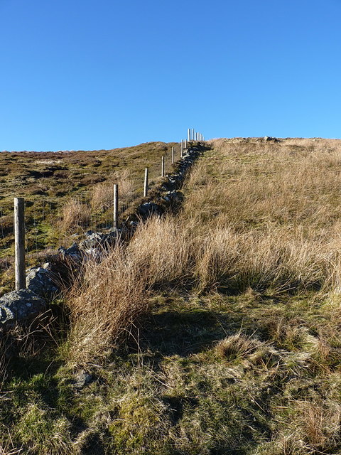
Old field boundary
This old wall, now supplemented by the more modern fence, dates from at least the 1870s, as the boundary line is marked on the 1886 map, surveyed between 1875 and 1885. There is a series of benchmarks marked on that map, but I didn't spot any of them as I came down alongside the wall.
 Map © Crown Copyright")
TIP: Click the map for more Large scale mapping
- Grid Square
- SJ0829, 9 images (more nearby 🔍)
- Photographer
- Richard Law (more nearby)
- Date Taken
- Sunday, 25 February, 2018 (more nearby)
- Submitted
- Friday, 2 March, 2018
- Subject Location
-
OSGB36:
 SJ 0846 2978 [10m precision]
WGS84: 52:51.4620N 3:21.6596W - Camera Location
-
OSGB36: SJ 08480 29739
- View Direction
- North-northwest (about 337 degrees)