2018
SD2795 : Torver Beck
taken 6 years ago, near to Torver, Cumbria, England
This is 1 of 2 images, with title Torver Beck in this square
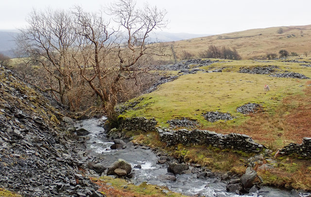
Torver Beck
Torver Beck flowing past the disused Banishead Quarry. Some of the quarry spoil is seen at the left side of the image.
 Map © Crown Copyright")
TIP: Click the map for more Large scale mapping
- Grid Square
- SD2795, 23 images (more nearby 🔍)
- Photographer
- Trevor Littlewood (more nearby)
- Date Taken
- Saturday, 10 March, 2018 (more nearby)
- Submitted
- Tuesday, 13 March, 2018
- Subject Location
-
OSGB36:
 SD 2792 9587 [10m precision]
WGS84: 54:21.1948N 3:6.6318W - Camera Location
-
OSGB36: SD 2789 9592
- View Direction
- South-southeast (about 157 degrees)