2018
SH6846 : Main incline
taken 6 years ago, near to Tanygrisiau, Gwynedd, Wales
Main incline
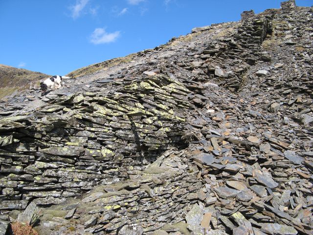
The main incline which descended from the upper levels of the quarry to the Cross and London mills is shown optimistically on the modern OS map at larger scales, but like the mills that it served it has now gone. It is cut by a modern haul-road at this point, and never resurfaces from beneath more recent tipping. My assistant Tegid is indicating how it used to work.
 Map © Crown Copyright")
TIP: Click the map for more Large scale mapping
- Grid Square
- SH6846, 24 images (more nearby 🔍)
- Photographer
- Jonathan Wilkins (more nearby)
- Date Taken
- Friday, 20 April, 2018 (more nearby)
- Submitted
- Thursday, 26 April, 2018
- Subject Location
-
OSGB36:
 SH 6822 4605 [10m precision]
WGS84: 52:59.7310N 3:57.8954W - Camera Location
-
OSGB36: SH 6822 4605
- View Direction
- NORTH (about 0 degrees)