2018
TM3698 : The Old Bank
taken 6 years ago, near to Loddon, Norfolk, England
This is 1 of 2 images, with title The Old Bank in this square
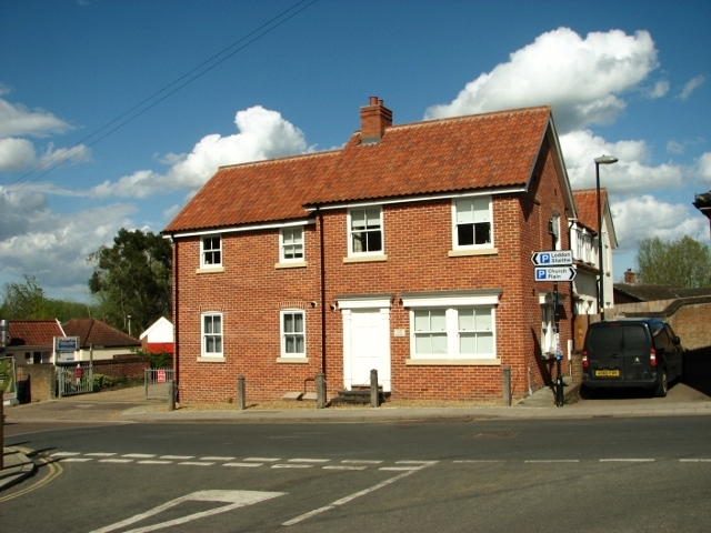
The Old Bank
The house depicted here was built on the site of the Midland Bank which later became the police station.
Loddon is a market town in the Broadland district in South Norfolk, located on the River Chet, where there is a marina and staithes once used by the wherries. The watermill > Link by the bridge across the river is recorded to be the oldest building in the town. The town centre has been designated as a conservation area and is made up of many period properties > Link. Most of the village shops > Link are situated along Bridge Street > Link - the main thoroughfare, as is Holy Trinity church > Link.
Loddon is a market town in the Broadland district in South Norfolk, located on the River Chet, where there is a marina and staithes once used by the wherries. The watermill > Link by the bridge across the river is recorded to be the oldest building in the town. The town centre has been designated as a conservation area and is made up of many period properties > Link. Most of the village shops > Link are situated along Bridge Street > Link - the main thoroughfare, as is Holy Trinity church > Link.
 Map © Crown Copyright")
TIP: Click the map for more Large scale mapping
- Grid Square
- TM3698, 417 images (more nearby 🔍)
- Photographer
- Evelyn Simak (more nearby)
- Date Taken
- Thursday, 26 April, 2018 (more nearby)
- Submitted
- Friday, 27 April, 2018
- Subject Location
-
OSGB36:
 TM 3616 9882 [10m precision]
WGS84: 52:32.1600N 1:28.8474E - Camera Location
-
OSGB36: TM 3614 9882
- View Direction
- East-northeast (about 67 degrees)