2018
NU0119 : Ploughed field at Calder Farm
taken 6 years ago, near to Roddam, Northumberland, England
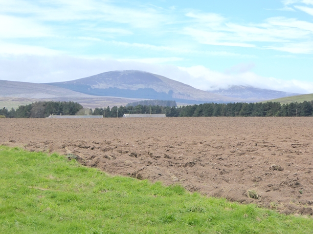
Ploughed field at Calder Farm
The roofs of Calder Farm can be seen in the middle distance. Beyond are the Cheviot Hills - one topped by cloud
 Map © Crown Copyright")
TIP: Click the map for more Large scale mapping
- Grid Square
- NU0119, 17 images (more nearby 🔍)
- Photographer
- Oliver Dixon (more nearby)
- Date Taken
- Friday, 4 May, 2018 (more nearby)
- Submitted
- Saturday, 5 May, 2018
- Subject Location
-
OSGB36:
 NU 0156 1970 [10m precision]
WGS84: 55:28.2676N 1:58.6127W - Camera Location
-
OSGB36: NU 01713 19718
- View Direction
- WEST (about 270 degrees)