2018
SX8963 : Torbay-Totnes Trail, Cockington valley
taken 6 years ago, near to Cockington, Torbay, England
This is 1 of 3 images, with title Torbay-Totnes Trail, Cockington valley in this square
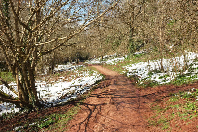
Torbay-Totnes Trail, Cockington valley
The trail follows footpath PN 131 up the valley. The snow that fell so heavily two days earlier is disappearing fast.
 Map © Crown Copyright")
TIP: Click the map for more Large scale mapping
- Grid Square
- SX8963, 672 images (more nearby 🔍)
- Photographer
- Derek Harper (more nearby)
- Date Taken
- Tuesday, 20 March, 2018 (more nearby)
- Submitted
- Thursday, 10 May, 2018
- Subject Location
-
OSGB36:
 SX 8974 6354 [10m precision]
WGS84: 50:27.6776N 3:33.2858W - Camera Location
-
OSGB36: SX 8977 6352
- View Direction
- West-northwest (about 292 degrees)