2007
SH7145 : Lefel Dwr Oer from the north
taken 17 years ago, near to Congl-y-Wal, Gwynedd, Wales
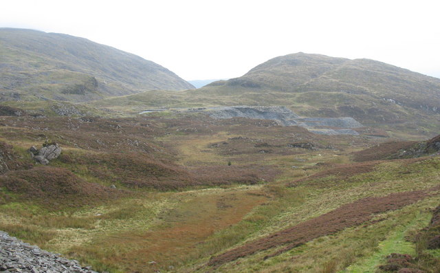
Lefel Dwr Oer from the north
Lefel Dwr Oer was the site of the reduction area of Graig-ddu Quarry between the 1860s and the 1930s. It is situated between pitches No4 and No3 of the Graig-ddu inclined plane. The Llynnau Dwr Oer ponds can be seen east of the waste tips.
 Map © Crown Copyright")
TIP: Click the map for more Large scale mapping
- Grid Square
- SH7145, 66 images (more nearby 🔍)
- Photographer
- Eric Jones (more nearby)
- Date Taken
- Friday, 28 September, 2007 (more nearby)
- Submitted
- Sunday, 7 October, 2007
- Subject Location
-
OSGB36:
 SH 714 454 [100m precision]
WGS84: 52:59.4445N 3:54.9591W - Camera Location
-
OSGB36: SH 712 459
- View Direction
- South-southeast (about 157 degrees)