2018
NY8338 : Far High House
taken 6 years ago, near to Wearhead, County Durham, England
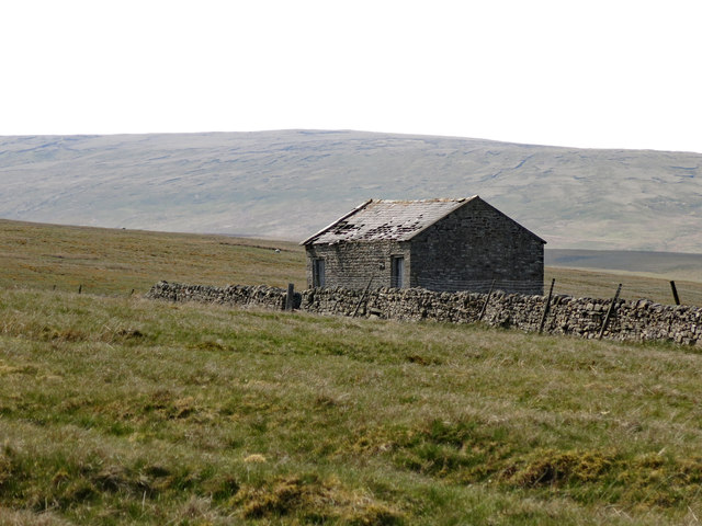
Far High House
See NY8241 : Whitestone House. In the 2nd edition of her book, Christine Ruskin says that records of the building first appear in 1851, when it was known as High House. The next house to the east was also known as High House - see NY8438 : High House. By 1896 the building in the photo above was known as Far High House.
The remote position of the building can be seen in NY8338 : Burnhope Reservoir below Far High House (taken from the north side of Burnhope Reservoir).
The remote position of the building can be seen in NY8338 : Burnhope Reservoir below Far High House (taken from the north side of Burnhope Reservoir).
 Map © Crown Copyright")
TIP: Click the map for more Large scale mapping
- Grid Square
- NY8338, 36 images (more nearby 🔍)
- Photographer
- Mike Quinn (more nearby)
- Date Taken
- Monday, 21 May, 2018 (more nearby)
- Submitted
- Monday, 11 June, 2018
- Subject Location
-
OSGB36:
 NY 8392 3817 [10m precision]
WGS84: 54:44.2944N 2:15.0759W - Camera Location
-
OSGB36: NY 8406 3816
- View Direction
- WEST (about 270 degrees)