2007
SH6262 : Carnedd Y Filiast Summit
taken 17 years ago, 3 km from Mynydd Llandygái, Gwynedd, Wales
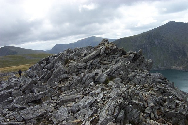
Carnedd Y Filiast Summit
A Southeasterly view of Carnedd y Filiast Summit with Y Garn ahead in the far distance and Foel Goch to the left and Elidir Fawr to the right. Marchlyn Mawr reservoir can also be seen at the base of Elidir Fawr.
 Map © Crown Copyright")
TIP: Click the map for more Large scale mapping
- Grid Square
- SH6262, 45 images (more nearby 🔍)
- Photographer
- Terry Hughes (more nearby)
- Date Taken
- Wednesday, 29 August, 2007 (more nearby)
- Submitted
- Wednesday, 10 October, 2007
- Subject Location
-
OSGB36:
 SH 62040 62742 [1m precision]
WGS84: 53:8.6345N 4:3.8461W - Camera Location
-
OSGB36: SH 62040 62742
- View Direction
- Southeast (about 135 degrees)