2018
TG2308 : 12-16 All Saints Green
taken 6 years ago, near to Norwich, Norfolk, England
This is 1 of 143 images, with title starting with 1 in this square
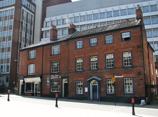
12-16 All Saints Green
This late 18th century Grade 2 listed building used to be a pair of houses but currently houses offices and shops. The shop front dates from the 19th century. Two old parish boundary markers > Link are mounted on the right gable end, obscured by a drainage pipe.
 Map © Crown Copyright")
TIP: Click the map for more Large scale mapping
- Grid Square
- TG2308, 6226 images (more nearby 🔍)
- Photographer
- Evelyn Simak (more nearby)
- Date Taken
- Sunday, 24 June, 2018 (more nearby)
- Submitted
- Tuesday, 26 June, 2018
- Subject Location
-
OSGB36:
 TG 2311 0817 [10m precision]
WGS84: 52:37.5248N 1:17.7008E - Camera Location
-
OSGB36: TG 2313 0819
- View Direction
- Southwest (about 225 degrees)