2018
HP6312 : Former (CoS) Church, B9087, Haroldswick
taken 6 years ago, near to Haroldswick, Unst, Shetland Islands, Scotland
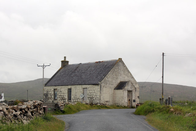
Former (CoS) Church, B9087, Haroldswick
Known locally as the White Hall, this was originally a U.F. Church. The first OS map that shows this building is in the 1920s and a date stone for June 1912 is incorporated in the fabric of the building.
 Map © Crown Copyright")
TIP: Click the map for more Large scale mapping
- Grid Square
- HP6312, 360 images (more nearby 🔍)
- Photographer
- Jo and Steve Turner (more nearby)
- Date Taken
- Monday, 25 June, 2018 (more nearby)
- Submitted
- Sunday, 22 July, 2018
- Subject Location
-
OSGB36:
 HP 6368 1265 [10m precision]
WGS84: 60:47.5026N 0:49.9261W - Camera Location
-
OSGB36: HP 6371 1271
- View Direction
- South-southwest (about 202 degrees)