2018
SS1248 : Lundy Island : Hen and Chickens
taken 6 years ago, 5 km NNW of Lundy, Devon, England
This is 1 of 2 images, with title Lundy Island : Hen and Chickens in this square
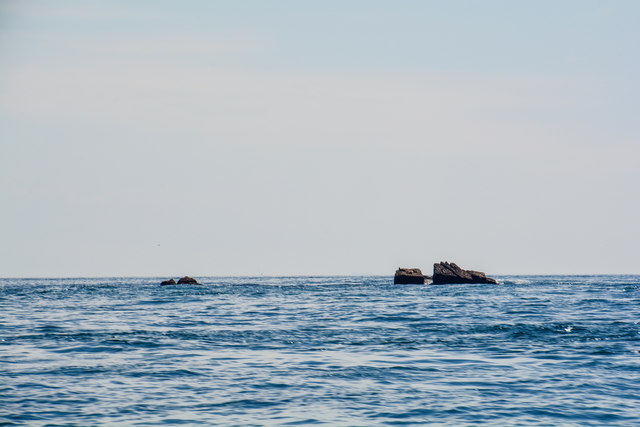
Lundy Island : Hen and Chickens
Hen and Chickens is a rock and is nearby to Lundy and Rat Island.
 Map © Crown Copyright")
TIP: Click the map for more Large scale mapping
- Grid Square
- SS1248, 15 images (more nearby 🔍)
- Photographer
- Lewis Clarke (more nearby)
- Date Taken
- Sunday, 15 July, 2018 (more nearby)
- Submitted
- Tuesday, 24 July, 2018
- Subject Location
-
OSGB36:
 SS 1279 4829 [10m precision]
WGS84: 51:12.1839N 4:40.8714W - Camera Location
-
OSGB36: SS 12940 48803
- View Direction
- South-southwest (about 202 degrees)