2018
NZ2658 : Access control on the Angel Cycleway
taken 6 years ago, near to Lamesley, Gateshead, England
This is 1 of 2 images, with title Access control on the Angel Cycleway in this square
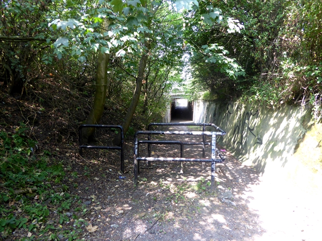
Access control on the Angel Cycleway
This access control is remarkably ineffective as there is a large gap to the right through which traffic can pass. Ahead is the subway under the Durham Road (A167).
 Map © Crown Copyright")
TIP: Click the map for more Large scale mapping
- Grid Square
- NZ2658, 32 images (more nearby 🔍)
- Photographer
- Oliver Dixon (more nearby)
- Date Taken
- Thursday, 26 July, 2018 (more nearby)
- Submitted
- Saturday, 28 July, 2018
- Subject Location
-
OSGB36:
 NZ 2644 5811 [10m precision]
WGS84: 54:55.0198N 1:35.3438W - Camera Location
-
OSGB36: NZ 26466 58113
- View Direction
- WEST (about 270 degrees)