2018
SK3727 : Swarkestone Causeway 11
taken 6 years ago, near to Stanton by Bridge, Derbyshire, England
Swarkestone Causeway 11
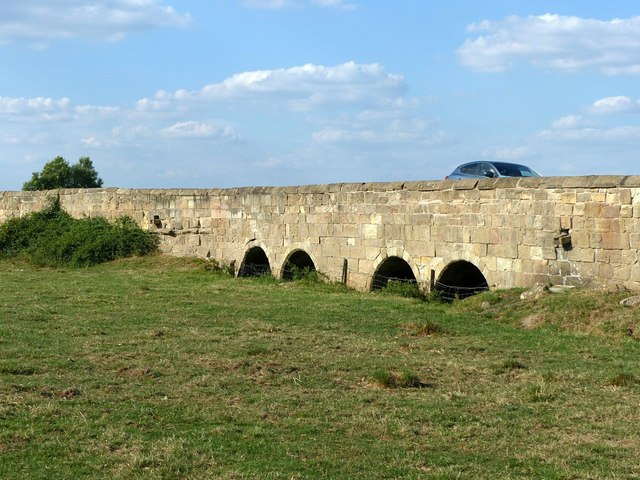
This dates from the late 13th or early 14th century, Listed Grade I and also a Scheduled Monument. It was widened on the eastern side, principally in 1799, but much of the masonry on this section is medieval. This is towards the southern end of the causeway, described in the Listing as follows: a medieval cutwater to east flanked by later arches (The cutwater is not visible from this side).
Click Link to start the sequence, Link for the next picture.
Click Link to start the sequence, Link for the next picture.
 Map © Crown Copyright")
TIP: Click the map for more Large scale mapping
- Grid Square
- SK3727, 42 images (more nearby 🔍)
- Photographer
- Alan Murray-Rust (more nearby)
- Date Taken
- Sunday, 5 August, 2018 (more nearby)
- Submitted
- Thursday, 16 August, 2018
- Subject Location
-
OSGB36:
 SK 3706 2773 [10m precision]
WGS84: 52:50.7484N 1:27.0714W - Camera Location
-
OSGB36: SK 3705 2771
- View Direction
- Northeast (about 45 degrees)