2018
NS1181 : Clachaig
taken 6 years ago, near to Clachaig, Argyll And Bute, Scotland
This is 1 of 2 images, with title Clachaig in this square
Clachaig
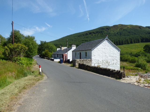
White houses and a red phone box by the B836 road.
The hamlet of Clachaig, Cowal
Taken largely from wikipedia Link
...
"Clachaig is a small settlement on the Cowal peninsula in Argyll and Bute. Located on the B836 road between the Holy Loch and Loch Striven, the hamlet is just over a mile long. Clachaig is a Gaelic word meaning 'stone place'.
The Hamlet consists of twenty-two houses and was built for accommodation for the workers of the powder mill which manufactured gunpowder."
 Map © Crown Copyright")
TIP: Click the map for more Large scale mapping
- Grid Square
- NS1181, 32 images (more nearby 🔍)
- Photographer
- Thomas Nugent (more nearby)
- Date Taken
- Monday, 2 July, 2018 (more nearby)
- Submitted
- Sunday, 19 August, 2018
- Subject Location
-
OSGB36:
 NS 1177 8155 [10m precision]
WGS84: 55:59.3927N 5:1.1572W - Camera Location
-
OSGB36: NS 1175 8156
- View Direction
- East-southeast (about 112 degrees)