2007
SX2980 : Trelaske Mill
taken 17 years ago, near to South Petherwin, Cornwall, England
This is 1 of 2 images, with title Trelaske Mill in this square
Trelaske Mill
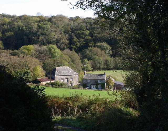
SX2980 : Trelaske Mill and the adjacent farmhouse seen from the steep lane from Trelaske House. The buildings are in the valley of the River Inny. On the eastern slope is Honiton Wood.
 Map © Crown Copyright")
TIP: Click the map for more Large scale mapping
- Grid Square
- SX2980, 6 images (more nearby 🔍)
- Photographer
- Derek Harper (more nearby)
- Date Taken
- Thursday, 18 October, 2007 (more nearby)
- Submitted
- Saturday, 20 October, 2007
- Subject Location
-
OSGB36:
 SX 2975 8027 [10m precision]
WGS84: 50:35.8356N 4:24.4156W - Camera Location
-
OSGB36: SX 2962 8024
- View Direction
- East-northeast (about 67 degrees)