2018
SP3060 : Countryside southwest of M40 junction 13
taken 6 years ago, near to Bishop's Tachbrook, Warwickshire, England
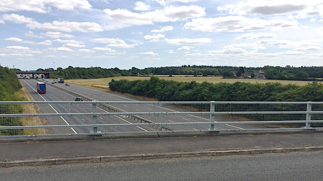
Countryside southwest of M40 junction 13
The view is roughly southeast from the Hareway Lane overbridge. Junction 13 is on the left; it's restricted to southbound entry, northbound exit. Oakley Wood Farm is on the right, Oakley Wood beyond it. The view northwest is SP2960 : Derelict barn by M40 near Bishop's Tachbrook.
M40 Motorway
The M40 Motorway runs 89 miles between London and Birmingham. Built in several stages between 1967 and 1990, it provides an alternative route to the M1/M6 route between the two cities.
 Map © Crown Copyright")
TIP: Click the map for more Large scale mapping
- Grid Square
- SP3060, 39 images (more nearby 🔍)
- Photographer
- Robin Stott (more nearby)
- Date Taken
- Wednesday, 1 August, 2018 (more nearby)
- Submitted
- Sunday, 23 September, 2018
- Subject Location
-
OSGB36:
 SP 3040 6026 [10m precision]
WGS84: 52:14.3817N 1:33.3736W - Camera Location
-
OSGB36: SP 3022 6060
- View Direction
- South-southeast (about 157 degrees)