2006
V4178 : Valentia Harbour
taken 18 years ago, near to Knight's Town, Co Kerry, Ireland
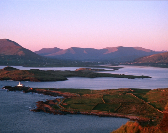
Valentia Harbour
Valentia Harbour, showing the southern shoulder of Knocknadobar on the left, Beginis in the centre of the harbour, Cromwell Point lighthouse, and at the extreme right-hand side, Carrantuohill, Ireland's highest mountain just visible in the distance.
Loading map... (JavaScript required)
- Grid Square
- V4178 (more nearby 🔍)
- Photographer
- Adrian Beney (more nearby)
- Date Taken
- Thursday, 18 May, 2006 (more nearby)
- Submitted
- Tuesday, 23 October, 2007
- Subject Location
-
Irish:
 V 417 784 [100m precision]
WGS84: 51:56.1860N 10:18.1496W - Camera Location
-
Irish: V 383 770
- View Direction
- East-northeast (about 67 degrees)