2007
NS6068 : Lanarkshire and Dunbartonshire Railway Trackbed
taken 16 years ago, near to Springburn, Glasgow, Scotland
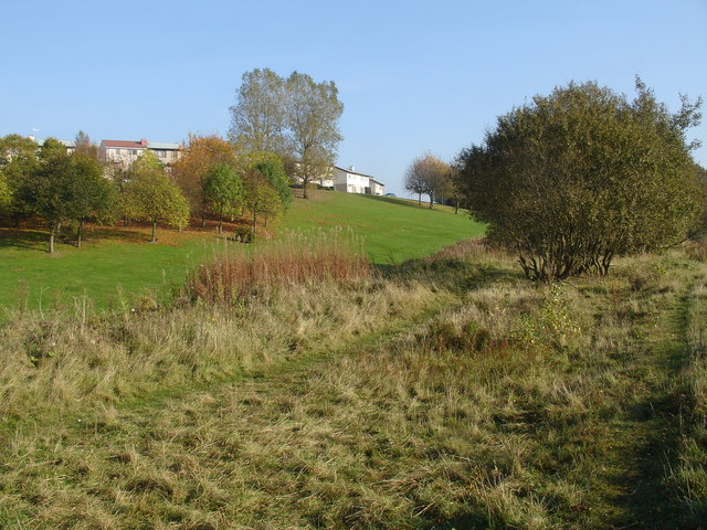
Lanarkshire and Dunbartonshire Railway Trackbed
This rough terrain is the route (on an embankment) of the old Lanarkshire and Dunbartonshire Railway, which linked Maryhill Central to Springburn Park goods station (Located adjacent to Farmfoods close to Balgrayhill Rd)). No formal path exists, but it is possible to follow the route all the way to Stobhill Hospital.
 Map © Crown Copyright")
TIP: Click the map for more Large scale mapping
- Grid Square
- NS6068, 139 images (more nearby 🔍)
- Photographer
- Raymond Okonski (more nearby)
- Date Taken
- Tuesday, 23 October, 2007 (more nearby)
- Submitted
- Tuesday, 23 October, 2007
- Subject Location
-
OSGB36:
 NS 602 688 [100m precision]
WGS84: 55:53.5615N 4:14.2242W - Camera Location
-
OSGB36: NS 601 688
- View Direction
- Northeast (about 45 degrees)