2007
J3674 : The Dee Street flyover, Belfast
taken 16 years ago, near to Belfast, Co Antrim, Northern Ireland
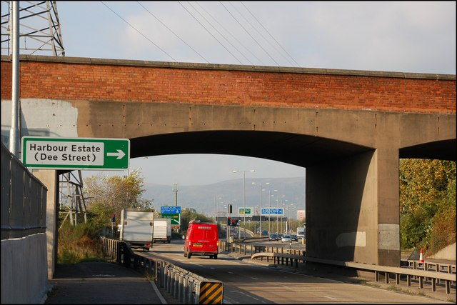
The Dee Street flyover, Belfast
The Sydenham bypass was conceived in 1938 and opened in 1959. At the time the land to the south consisted of tightly-packed terrace houses and, to the north, the Harland & Wolff shipyard was close to the peak of its employment. Dee Street gave access from the former to the latter. Much has changed and Dee Street is now a shortcut to the Sydenham bypass avoiding the three-way junction at the bottom of the Newtownards Road. The view is towards the city centre. There are plans to add a third lane, in each direction, which might include the replacement of this bridge. See also J3674 : The Dee Street flyover, Belfast (2).
The Sydenham bypass, Belfast
Approximately 2½ miles of dual carriageway forming part of the Belfast Bangor Road. It runs from the end of the M3 to Tillysburn, parallel to the Belfast Bangor railway and also serves the George Best Belfast City Airport. It replaced the Holywood Road as the main road to Holywood and Bangor. There are plans for major improvements at the junction with Dee Street.
Loading map... (JavaScript required)
- Grid Square
- J3674, 822 images (more nearby 🔍)
- Photographer
- Albert Bridge (more nearby)
- Date Taken
- Wednesday, 24 October, 2007 (more nearby)
- Submitted
- Wednesday, 24 October, 2007
- Subject Location
-
Irish:
 J 360 747 [100m precision]
WGS84: 54:36.1707N 5:53.7632W - Camera Location
-
Irish: J 360 747
- View Direction
- WEST (about 270 degrees)