2005
SU9159 : Bending Oak
taken 19 years ago, 3 km from Donkey Town, Surrey, England
Bending Oak
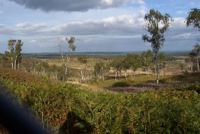
This picture, taken from the edge of the square on Chobham Ridges through the impenetrable boundary fence of the Range Danger Area (see SU9159), shows the whole of the square spread out below. In the centre of the picture is the mound of Bending Oak. The low-lying area around it is part of Colony Bog.
 Map © Crown Copyright")
TIP: Click the map for more Large scale mapping
- Grid Square
- SU9159, 18 images (more nearby 🔍)
- Photographer
- Ron Strutt (more nearby)
- Date Taken
- Thursday, 29 September, 2005 (more nearby)
- Submitted
- Thursday, 29 September, 2005
- Subject Location
-
OSGB36:
 SU 914 595 [100m precision]
WGS84: 51:19.6359N 0:41.3755W - Camera Location
-
OSGB36: SU 910 593