2005
SU9261 : Highland cattle on Folly Bog
taken 19 years ago, near to Lightwater, Surrey, England
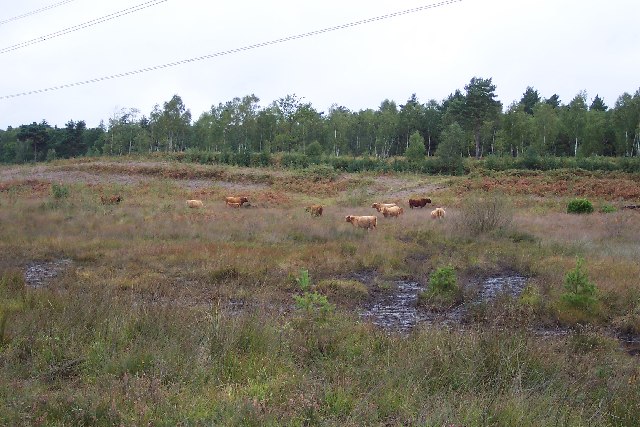
Highland cattle on Folly Bog
Folly Bog is an area that lies between the northern edge of the Pirbright Ranges danger area and Red Road. Although owned by the MOD it is cared for by the Surrey Wildlife Trust. As an experiment and in order to help the boggy conditions to revive, the Trust has brought in a herd of Highland cattle to keep the invasive scrub under control. So far, according to the rangers, the experiment seems to be working well, tender birch shoots seeming to be very much to the cattle's liking. The boggy conditions can be seen in the foreground (and around the photographer's feet!). Pity about the overhead power lines.
 Map © Crown Copyright")
TIP: Click the map for more Large scale mapping
- Grid Square
- SU9261, 41 images (more nearby 🔍)
- Photographer
- Ron Strutt (more nearby)
- Date Taken
- Friday, 30 September, 2005 (more nearby)
- Submitted
- Friday, 30 September, 2005
- Subject Location
-
OSGB36:
 SU 9229 6111 [10m precision]
WGS84: 51:20.4957N 0:40.5843W