2018
TM1312 : St Osyth Ditch
taken 5 years ago, near to Seawick, Essex, England
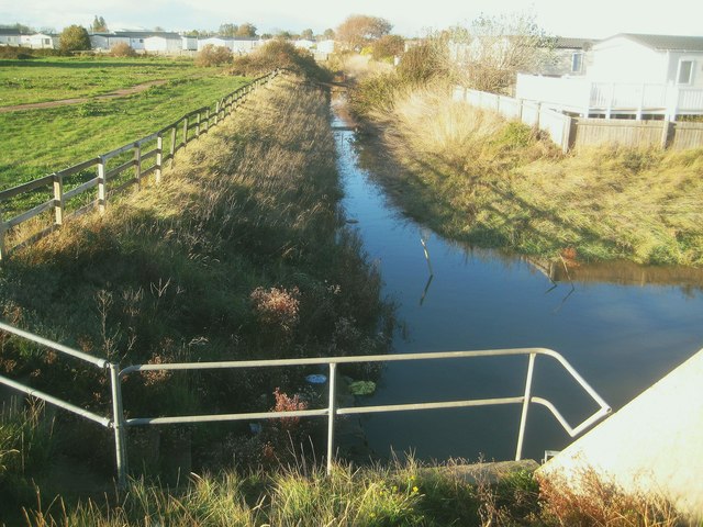
St Osyth Ditch
St Osyth Ditch drains St Osyth Marsh. This is the view looking upstream from the Cockett Wick Sluice which allows water to drain out through the sea defence wall into the North Sea. Jaywick Ditch enters at the right so this is the confluence between the two ditches.
 Map © Crown Copyright")
TIP: Click the map for more Large scale mapping
- Grid Square
- TM1312, 25 images (more nearby 🔍)
- Photographer
- Nigel Cox (more nearby)
- Date Taken
- Sunday, 28 October, 2018 (more nearby)
- Submitted
- Saturday, 3 November, 2018
- Subject Location
-
OSGB36:
 TM 1368 1277 [10m precision]
WGS84: 51:46.3678N 1:5.7468E - Camera Location
-
OSGB36: TM 1369 1271
- View Direction
- NORTH (about 0 degrees)