M2104 : R480, The Burren
taken 6 years ago, 4 km SSW of Ballyvaghan, Co Clare, Ireland
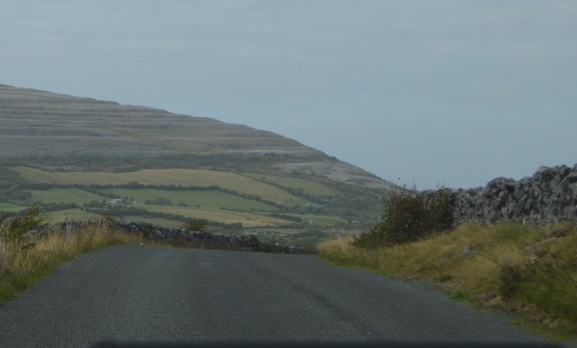
The R480 in County Clare runs 14km from the N67 at Newtown, 1.5 km south-southwest of Ballyvaghan, to the R476 at Leamaneh Cross via the Burren.
The Burren and Cliffs of Moher Geopark is an internationally designated area of geological interest in County Clare. It was the third Geopark to be designated in Ireland, and is recognised at both European and global levels. It is sometimes branded as "the Burren and Cliffs of Moher Global UNESCO Geopark."
The Burren comprises dramatic glaciated karst landscapes on Irelands Atlantic coast which have been fashioned in a variety of limestones, sandstones and siltstones originating during the Carboniferous period. The nearby Cliffs of Moher are vertical sandstone and shale sea-cliffs, the highest in Europe, which rise to a height of over 200m in places and which have long drawn sightseers to the area.
- Grid Square
- M2104, 6 images (more nearby 🔍)
- Photographer
- N Chadwick (more nearby)
- Date Taken
- Tuesday, 31 July, 2018 (more nearby)
- Submitted
- Wednesday, 14 November, 2018
- Subject Location
-
Irish:
 M 219 040 [100m precision]
WGS84: 53:4.9203N 9:9.9192W - Camera Location
-
Irish: M 219 040
- View Direction
- NORTH (about 0 degrees)