2018
NJ1731 : The Other Side of Strath Avon
taken 5 years ago, near to Drumin, Moray, Scotland
The Other Side of Strath Avon
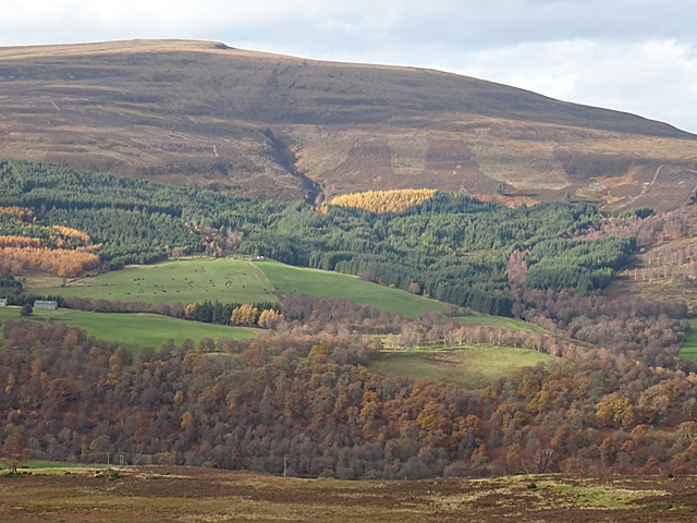
The farm at the apex of the fields is Tomnabrilach, and to its right and above the trees is the gully of the Burn of Scoupeck. The summit is Creag an Tarmachain, 'Crag of the Ptarmigan'. Seen from Hill of Deskie on the Tomintoul Spur of the Speyside Way Link .
.
Speyside Way
The Speyside Way is a long-distance path linking Buckie on the Moray Coast to Aviemore in Strathspey.
The official Speyside Way web site at Link
Beware a similar-sounding unofficial web site ending in .org that contains inaccurate information but tends to come up in search engines well ahead of the official one!
 Map © Crown Copyright")
TIP: Click the map for more Large scale mapping
- Grid Square
- NJ1731, 5 images (more nearby 🔍)
- Photographer
- Anne Burgess (more nearby)
- Date Taken
- Monday, 12 November, 2018 (more nearby)
- Submitted
- Sunday, 18 November, 2018
- Subject Location
-
OSGB36:
 NJ 1727 3113 [10m precision]
WGS84: 57:21.7859N 3:22.6165W - Camera Location
-
OSGB36: NJ 1997 3122
- View Direction
- WEST (about 270 degrees)