2018
SE1422 : Benchmark on #2 Harley Place (Harley Street face)
taken 6 years ago, near to Brighouse, Calderdale, England
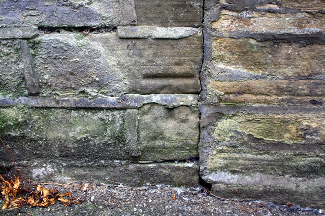
Benchmark on #2 Harley Place (Harley Street face)
Ordnance Survey cut mark benchmark described on the Bench Mark Database at Link
 Map © Crown Copyright")
TIP: Click the map for more Large scale mapping
- Grid Square
- SE1422, 1144 images (more nearby 🔍)
- Photographer
- Roger Templeman (more nearby)
- Date Taken
- Wednesday, 18 July, 2018 (more nearby)
- Submitted
- Tuesday, 8 January, 2019
- Subject Location
-
OSGB36:
 SE 1432 2237 [10m precision]
WGS84: 53:41.8546N 1:47.0755W - Camera Location
-
OSGB36: SE 1432 2237
- View Direction
- Southwest (about 225 degrees)