2019
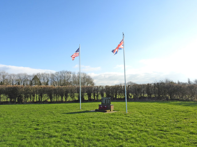
TG0207 : U.S.A.A.F. Liberator 42-95160, aircrew memorial
taken 5 years ago, near to Garvestone, Norfolk, England
This is 1 of 2 images, with title U.S.A.A.F. Liberator 42-95160, aircrew memorial in this square
U.S.A.A.F. Liberator 42-95160, aircrew memorial
B24 Liberator 42-95160 crashed on this site after taking off from North Pickenham. All ten of the crew were killed as well as two firefighters who responded to the crash and were killed when one of the bombs on board exploded.
The memorial which can be seen here tells its own story. Link
The memorial which can be seen here tells its own story. Link
Wartime aircraft crash Memorials
During the Second World War hundreds of aircrew were lost in accidents while training, landing, taking off or attempting to get back to their base with a badly damaged aircraft.
By creating this shared description and collecting them into one place I will not only pay tribute to the men who lost their lives in the line of duty but hopefully give some scale to the cost in lives.
These are just the ones who have a memorial; there are hundreds more who have no memorial or were lost at sea. They should not be forgotten. Their lives were equally precious.
In Honour of those who served and in Memory of those who fell.
 Map © Crown Copyright")
TIP: Click the map for more Large scale mapping
- Grid Square
- TG0207, 58 images (more nearby 🔍)
- Photographer
- Adrian S Pye (more nearby)
- Date Taken
- Tuesday, 22 January, 2019 (more nearby)
- Submitted
- Tuesday, 22 January, 2019
- Subject Location
-
OSGB36:
 TG 02189 07268 [1m precision]
WGS84: 52:37.5302N 0:59.1501E - Camera Location
-
OSGB36: TG 0218 0728
- View Direction
- South-southeast (about 157 degrees)