2008
SK3166 : Old Guide Stone by the B5057, Darley Road crossroads
taken 16 years ago, 3 km from Spitewinter, Derbyshire, England
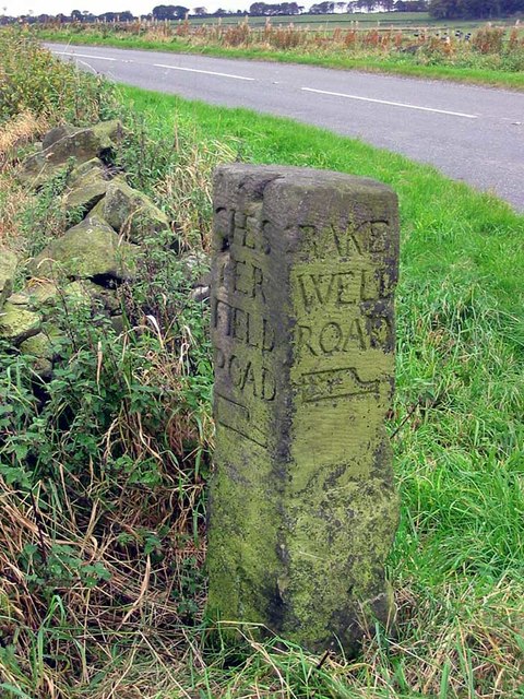
Old Guide Stone by the B5057, Darley Road crossroads
Moorland Guidestoop by the B5057, in parish of Ashover (North East Derbyshire District), Darley Road, East of Gladwin's Mark at junction with Alicehead Road, on grass verge.
Surveyed
Milestone Society National ID: DE_XASH01.
Surveyed
Milestone Society National ID: DE_XASH01.
National Survey of Wayside Features by The Milestone Society
These images are from Link
 Map © Crown Copyright")
TIP: Click the map for more Large scale mapping
- Grid Square
- SK3166, 20 images (more nearby 🔍)
- Photographer
- Milestone Society (more nearby)
- Date Taken
- 2008 (more nearby)
- Submitted
- Monday, 28 January, 2019
- Subject Location
-
OSGB36:
 SK 3162 6671 [10m precision]
WGS84: 53:11.7922N 1:31.6892W - Camera Location
-
OSGB36: SK 3162 6671
- View Direction
- WEST (about 270 degrees)