2005
TQ7484 : Barrier on Vange Creek
taken 19 years ago, near to Fobbing, Thurrock, England
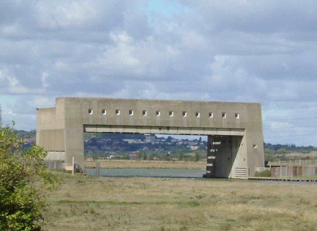
Barrier on Vange Creek
This view of the Movable Flood barrier on Vange creek was taken looking in a northerly direction. Vange on the southern edge of Basildon can be seen in the background.
 Map © Crown Copyright")
TIP: Click the map for more Large scale mapping
- Grid Square
- TQ7484, 21 images (more nearby 🔍)
- Photographer
- Glyn Baker (more nearby)
- Date Taken
- Sunday, 2 October, 2005 (more nearby)
- Submitted
- Sunday, 2 October, 2005
- Subject Location
-
OSGB36:
 TQ 740 843 [100m precision]
WGS84: 51:31.8478N 0:30.4289E - Camera Location
-
OSGB36: TQ 741 840