2018
NY5790 : Old Bridge Marker by Coal Grain Bridge, Bloody Bush Road
taken 6 years ago, near to Coal Grain [water Feature], Northumberland, Great Britain
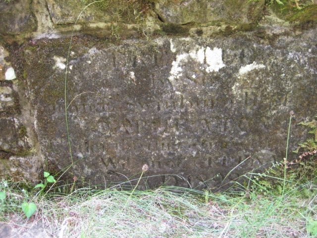
Old Bridge Marker by Coal Grain Bridge, Bloody Bush Road
Bridge Marker in parish of Kielder (Tynedale District), Bloody Bush Road, forestry track, parapet of Coal Grain Bridge.
Surveyed
Milestone Society National ID: NB_KIEL02br
Surveyed
Milestone Society National ID: NB_KIEL02br
National Survey of Wayside Features by The Milestone Society
These images are from Link
 Map © Crown Copyright")
TIP: Click the map for more Large scale mapping
- Grid Square
- NY5790, 9 images (more nearby 🔍)
- Photographer
- Milestone Society (more nearby)
- Date Taken
- 2018 (more nearby)
- Submitted
- Sunday, 3 February, 2019
- Subject Location
-
OSGB36:
 NY 57920 90585 [1m precision]
WGS84: 55:12.4626N 2:39.7663W - Camera Location
-
OSGB36: NY 57920 90585
- View Direction
- South-southwest (about 202 degrees)