2018
TM3692 : Old Boundary Marker by the A143, Yarmouth Road, Kirby Canes parish
taken 6 years ago, near to Kirby Row, Norfolk, England
Old Boundary Marker by the A143, Yarmouth Road, Kirby Canes parish
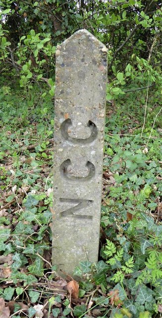
Municipal Boundary Marker by the A143, in parish of Kirby Canes (South Norfolk District), Yarmouth Road, on verge under the Ellingham sign, South side of road.
Inscription reads vertically:-
NCC
Surveyed
Milestone Society National ID: NO_KCANE01pb
Inscription reads vertically:-
NCC
Surveyed
Milestone Society National ID: NO_KCANE01pb
National Survey of Wayside Features by The Milestone Society
These images are from Link
 Map © Crown Copyright")
TIP: Click the map for more Large scale mapping
- Grid Square
- TM3692, 74 images (more nearby 🔍)
- Photographer
- Milestone Society (more nearby)
- Date Taken
- 2018 (more nearby)
- Submitted
- Monday, 11 February, 2019
- Subject Location
-
OSGB36:
 TM 36957 92955 [1m precision]
WGS84: 52:28.9815N 1:29.3007E - Camera Location
-
OSGB36: TM 36957 92955
- View Direction
- Southeast (about 135 degrees)