2005
SP2248 : The Lost Village of Whitchurch
taken 19 years ago, near to Alderminster, Warwickshire, England
The Lost Village of Whitchurch
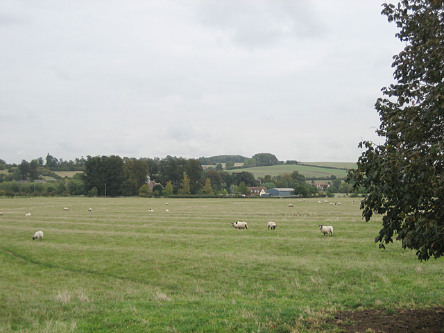
Ridge and furrow field system centred on a lost medieval village called Whitchurch. Looking east towards the isolated church and farm that remain, from the Crimscote to Wimpstone road.
 Map © Crown Copyright")
TIP: Click the map for more Large scale mapping
- Grid Square
- SP2248, 38 images (more nearby 🔍)
- Photographer
- Dave Bushell (more nearby)
- Date Taken
- Monday, 3 October, 2005 (more nearby)
- Submitted
- Monday, 3 October, 2005
- Subject Location
-
OSGB36:
 SP 226 485 [100m precision]
WGS84: 52:8.0659N 1:40.2300W - Camera Location
-
OSGB36: SP 222 484
- View Direction
- EAST (about 90 degrees)