2019
NZ4348 : Disused Railway, Seaham Harbour
taken 5 years ago, 3 km from Dalton-le-Dale, County Durham, England
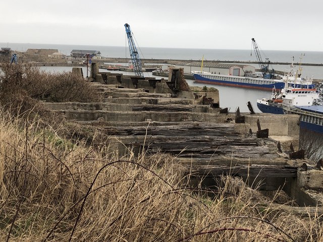
Disused Railway, Seaham Harbour
Seaham harbour had an extensive and complicated railway system up until the second half of the 20th century. The railway operated on two levels, the upper level bringing in goods (primarily coal) for loading onto ships via staiths, while the lower level allowed access to the dockside. The image shows the remains of a gantry supporting railway sleepers at the southern end of the harbour for the upper level rail complex.
 Map © Crown Copyright")
TIP: Click the map for more Large scale mapping
- Grid Square
- NZ4348, 35 images (more nearby 🔍)
- Photographer
- David Robinson (more nearby)
- Date Taken
- Sunday, 3 March, 2019 (more nearby)
- Submitted
- Thursday, 4 April, 2019
- Subject Location
-
OSGB36:
 NZ 4331 4895 [10m precision]
WGS84: 54:50.0108N 1:19.6367W - Camera Location
-
OSGB36: NZ 43287 48939
- View Direction
- East-northeast (about 67 degrees)