2007
SE6730 : St Mary's Church, Hemingbrough
taken 16 years ago, near to Hemingbrough, North Yorkshire, England
This is 1 of 2 images, with title St Mary's Church, Hemingbrough in this square
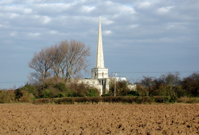
St Mary's Church, Hemingbrough
A church was recorded at Hemingbrough in 1086 and part of the structure of the Church of St. Mary the Virgin probably dates from the 11th century. The impressive spire rising to a height of 191 feet is thought likely to date from the first half of the 15th century, when John of Wessington spent a considerable sum of money on the church which was made a collegiate in 1427. The college was suppressed in 1545 shortly after the Dissolution. St. Mary's would once have stood much closer to the River Ouse which has since moved further west, with the track called Oldways Lane running along the riverbank.
 Map © Crown Copyright")
TIP: Click the map for more Large scale mapping
- Grid Square
- SE6730, 49 images (more nearby 🔍)
- Photographer
- Paul Glazzard (more nearby)
- Date Taken
- Saturday, 17 November, 2007 (more nearby)
- Submitted
- Tuesday, 20 November, 2007
- Subject Location
-
OSGB36:
 SE 673 306 [100m precision]
WGS84: 53:46.0496N 0:58.7918W - Camera Location
-
OSGB36: SE 671 303
- View Direction
- North-northeast (about 22 degrees)