2004
SH6743 : Tanygrisiau reservoir
taken 20 years ago, near to Tanygrisiau, Gwynedd, Wales
This is 1 of 11 images, with title Tanygrisiau reservoir in this square
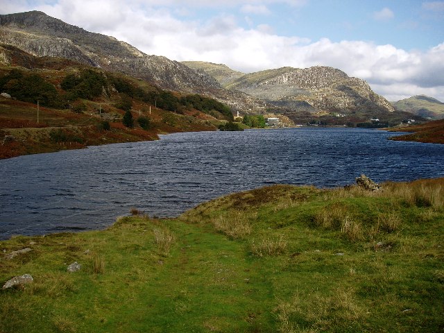
Tanygrisiau reservoir
The reservoir is the lower basin of a hydroelectric storage system, the other half of which is Llyn Stwlan. The diverted tracks of the Ffestiniog railway run on the opposite shore. The photograph was taken from just SE of the outflow. The hill in the background is Moel yr Hydd. The square contains mostly wet grassland on this side (E) of the stream, and steep moorland on the slopes of Moelwyn Mawr on the other. The western lakeside path crosses an abandoned mine.
 Map © Crown Copyright")
TIP: Click the map for more Large scale mapping
- Grid Square
- SH6743, 56 images (more nearby 🔍)
- Photographer
- Rudi Winter (more nearby)
- Date Taken
- Saturday, 9 October, 2004 (more nearby)
- Submitted
- Thursday, 6 October, 2005
- Subject Location
-
OSGB36:
 SH 678 437 [100m precision]
WGS84: 52:58.4581N 3:58.2130W - Camera Location
-
OSGB36: SH 679 435
- View Direction
- North-northwest (about 337 degrees)