2007
TQ3632 : Vinols Cross
taken 16 years ago, near to Sharpthorne, West Sussex, England
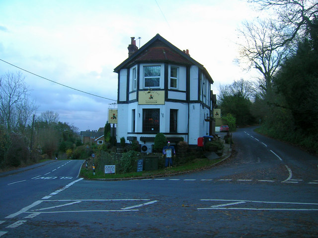
Vinols Cross
Top Road (left) heads to Sharpthorne and Forest Row; Highbrook Lane (right) heads to Burstow Hill and Ardingly; Church Hill (front) heads towards West Hoathly village centre; whilst The Hollow (out of shot to the left) goes to Selsfield Common and Turners Hill. The building in the midst of the roads is the Intrepid Fox public house. The stuffed dummy at the front is advertising a local farmers market.
 Map © Crown Copyright")
TIP: Click the map for more Large scale mapping
- Grid Square
- TQ3632, 288 images (more nearby 🔍)
- Photographer
- Simon Carey (more nearby)
- Date Taken
- Saturday, 1 December, 2007 (more nearby)
- Submitted
- Saturday, 1 December, 2007
- Subject Location
-
OSGB36:
 TQ 368 325 [100m precision]
WGS84: 51:4.5532N 0:2.9163W - Camera Location
-
OSGB36: TQ 367 325
- View Direction
- East-southeast (about 112 degrees)