2019
SZ5479 : Public footpath GL50
taken 5 years ago, near to Wroxall, Isle of Wight, England
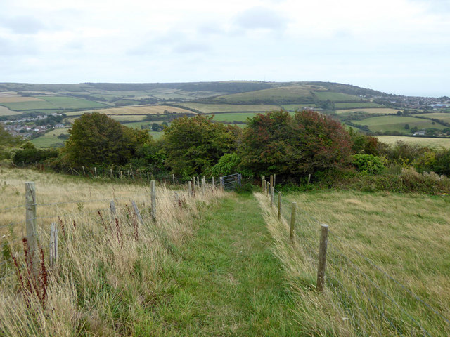
Public footpath GL50
The path cuts across a field to form a short cut to the vehicle route down from Stenbury Down towards Wroxall, at the expense of steep steps in the bushes ahead down to reach the vehicle byway, here a deeply sunken lane.
 Map © Crown Copyright")
TIP: Click the map for more Large scale mapping
- Grid Square
- SZ5479, 81 images (more nearby 🔍)
- Photographer
- Robin Webster (more nearby)
- Date Taken
- Saturday, 31 August, 2019 (more nearby)
- Submitted
- Wednesday, 4 September, 2019
- Subject Location
-
OSGB36:
 SZ 5406 7906 [10m precision]
WGS84: 50:36.5256N 1:14.2420W - Camera Location
-
OSGB36: SZ 54036 79074
- View Direction
- East-southeast (about 112 degrees)