1979
SX4553 : Mutton Cove, Devonport, 1979
taken 45 years ago, near to Cremyll, Cornwall, England
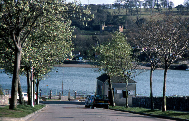
Mutton Cove, Devonport, 1979
This is the shore access road leading to Mutton Cove, adjacent to the Devonport South Dockyard photographed in 1979. Cremyll and Mount Edgecombe house can be seen on the Cornish side of the river Tamar.
 Map © Crown Copyright")
TIP: Click the map for more Large scale mapping
- Grid Square
- SX4553, 494 images (more nearby 🔍)
- Photographer
- Crispin Purdye (more nearby)
- Date Taken
- May 1979 (more nearby)
- Submitted
- Monday, 10 October, 2005
- Subject Location
-
OSGB36:
 SX 452 539 [100m precision]
WGS84: 50:21.8755N 4:10.6727W