2018
SS4630 : Irsha Street
taken 6 years ago, near to Appledore, Devon, England
This is 1 of 14 images, with title Irsha Street in this square
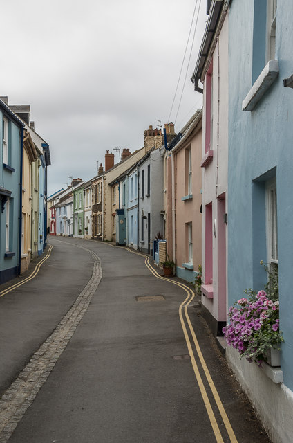
Irsha Street
Narrow street of colourful cottages following the shoreline of the Torridge Estuary. Irsha was once a hamlet separate from Appledore itself, with Irsha Street running the length of it. The houses date mainly from the 19th Century, but there are some earlier buildings. The ones on the right, with no 45 nearest, are part of a grade II listed group of cottages, 18th Century in the case of the nearest two and 16th or 17th Century in the case of no 41, third along with the ochre coloured front - see Link .
.
 Map © Crown Copyright")
TIP: Click the map for more Large scale mapping
- Grid Square
- SS4630, 353 images (more nearby 🔍)
- Photographer
- Ian Capper (more nearby)
- Date Taken
- Tuesday, 19 June, 2018 (more nearby)
- Submitted
- Sunday, 29 December, 2019
- Subject Location
-
OSGB36:
 SS 461 309 [100m precision]
WGS84: 51:3.4499N 4:11.8164W - Camera Location
-
OSGB36: SS 461 309
- View Direction
- West-northwest (about 292 degrees)