2007
TL7186 : Rightup Drove
taken 16 years ago, near to Hockwold Cum Wilton, Norfolk, England
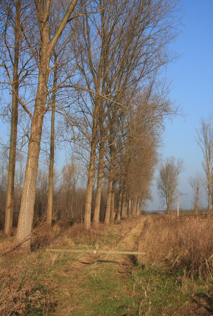
Rightup Drove
This track is part of the RSPB Lakenheath Fen, but is out of bounds to visitors, as indicated by the no entry symbol on the wooden pole at the start of the track.
 Map © Crown Copyright")
TIP: Click the map for more Large scale mapping
- Grid Square
- TL7186, 45 images (more nearby 🔍)
- Photographer
- Bob Jones (more nearby)
- Date Taken
- Wednesday, 19 December, 2007 (more nearby)
- Submitted
- Wednesday, 19 December, 2007
- Subject Location
-
OSGB36:
 TL 711 861 [100m precision]
WGS84: 52:26.7849N 0:31.0136E - Camera Location
-
OSGB36: TL 710 860
- View Direction
- North-northeast (about 22 degrees)