2005
SO7623 : New Houses, Highleadon
taken 19 years ago, near to Highleadon, Gloucestershire, England
New Houses, Highleadon
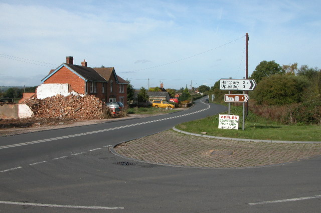
Road junction on the B4215 at Highleadon. The rubble is the remains of a demolished garage/filling station.
 Map © Crown Copyright")
TIP: Click the map for more Large scale mapping
- Grid Square
- SO7623, 16 images (more nearby 🔍)
- Photographer
- Philip Halling (more nearby)
- Date Taken
- Sunday, 9 October, 2005 (more nearby)
- Submitted
- Monday, 10 October, 2005
- Subject Location
-
OSGB36:
 SO 769 232 [100m precision]
WGS84: 51:54.4329N 2:20.1965W - Camera Location
-
OSGB36: SO 769 232
- View Direction
- Southwest (about 225 degrees)