2005
SO7722 : Battle of Barber's Bridge Monument
taken 19 years ago, near to Rudford, Gloucestershire, England
This is 1 of 2 images, with title Battle of Barber's Bridge Monument in this square
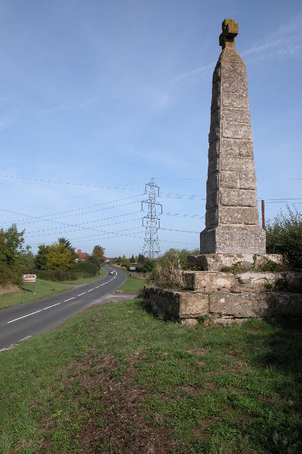
Battle of Barber's Bridge Monument
The monument commemorates the battle of Barber's Bridge which took place in 1643. The B4215 passes this spot, as does the former Gloucester and Hereford Canal, later superseded by the railway, both now long defunct. Today the Wysis Way, a long distance footpath connecting Offa's Dyke Path and the Thames Valley Path follows the course of the old railway at this point.
 Map © Crown Copyright")
TIP: Click the map for more Large scale mapping
- Grid Square
- SO7722, 27 images (more nearby 🔍)
- Photographer
- Philip Halling (more nearby)
- Date Taken
- Sunday, 9 October, 2005 (more nearby)
- Submitted
- Monday, 10 October, 2005
- Subject Location
-
OSGB36:
 SO 773 221 [100m precision]
WGS84: 51:53.8404N 2:19.8782W - Camera Location
-
OSGB36: SO 773 220
- View Direction
- NORTH (about 0 degrees)