2007
TQ4957 : Chevening Lane
taken 16 years ago, near to Chevening, Kent, England
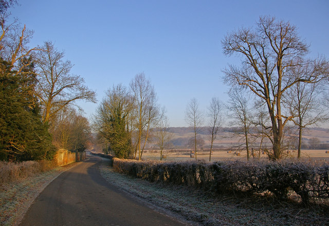
Chevening Lane
This is the lane leading into Chevening village. The wall on the left is that of the grounds of Chevening House, the official country residence of the Foreign Secretary. In the background are the North Downs.
 Map © Crown Copyright")
TIP: Click the map for more Large scale mapping
- Grid Square
- TQ4957, 71 images (more nearby 🔍)
- Photographer
- Ian Capper (more nearby)
- Date Taken
- Thursday, 20 December, 2007 (more nearby)
- Submitted
- Thursday, 20 December, 2007
- Subject Location
-
OSGB36:
 TQ 490 573 [100m precision]
WGS84: 51:17.7195N 0:8.1839E - Camera Location
-
OSGB36: TQ 490 572
- View Direction
- North-northwest (about 337 degrees)