2020
SX7480 : Tor on Hayne Down
taken 4 years ago, near to Manaton, Devon, England
This is 1 of 4 images, with title Tor on Hayne Down in this square
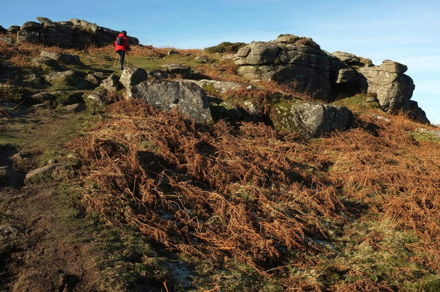
Tor on Hayne Down
Part of the impressive tor on the western summit of the hill. But the tor is unnamed on maps; however, it is referred to on the internet as Hayne Tor, which seems perfectly reasonable.
 Map © Crown Copyright")
TIP: Click the map for more Large scale mapping
- Grid Square
- SX7480, 112 images (more nearby 🔍)
- Photographer
- Derek Harper (more nearby)
- Date Taken
- Monday, 20 January, 2020 (more nearby)
- Submitted
- Sunday, 26 January, 2020
- Subject Location
-
OSGB36:
 SX 7429 8039 [10m precision]
WGS84: 50:36.5785N 3:46.6809W - Camera Location
-
OSGB36: SX 7433 8037
- View Direction
- West-northwest (about 292 degrees)