1968
SE0063 : Linton Falls and original Tin Bridge
taken 56 years ago, near to Grassington, North Yorkshire, England
This is 1 of 3 images, with title starting with Linton Falls and in this square
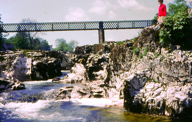
Linton Falls and original Tin Bridge
Water level is low in this summer view, which shows the limestone well. The original Tin Bridge has now been replaced with a wooden version.
 Map © Crown Copyright")
TIP: Click the map for more Large scale mapping
- Grid Square
- SE0063, 495 images (more nearby 🔍)
- Photographer
- Chris Coleman (more nearby)
- Date Taken
- July 1968 (more nearby)
- Submitted
- Thursday, 27 December, 2007
- Subject Location
-
OSGB36:
 SE 001 633 [100m precision]
WGS84: 54:3.9438N 1:59.9887W - Camera Location
-
OSGB36: SE 001 632
- View Direction
- Northwest (about 315 degrees)