2020
NJ9202 : Former Quarry
taken 4 years ago, near to Banchory-Devenick, Aberdeenshire, Scotland
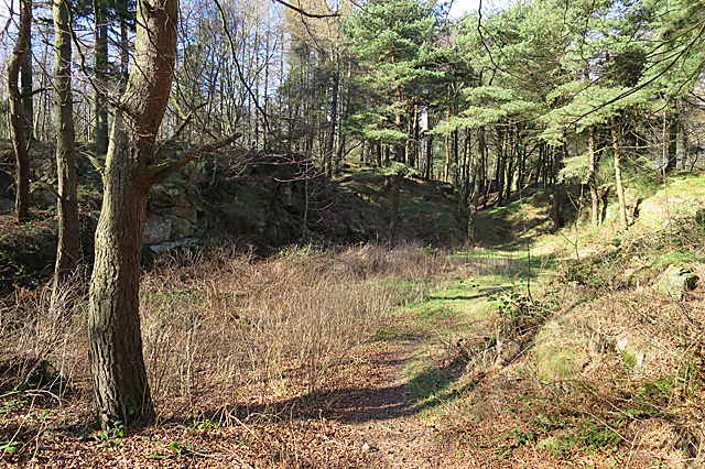
Former Quarry
The mid-19th century maps confirm my surmise that this hollow is a former quarry, though the geological map shows metamorphic bedrock here rather than granite.
 Map © Crown Copyright")
TIP: Click the map for more Large scale mapping
- Grid Square
- NJ9202, 52 images (more nearby 🔍)
- Photographer
- Anne Burgess (more nearby)
- Date Taken
- Friday, 20 March, 2020 (more nearby)
- Submitted
- Saturday, 21 March, 2020
- Subject Location
-
OSGB36:
 NJ 9227 0225 [10m precision]
WGS84: 57:6.6683N 2:7.7555W - Camera Location
-
OSGB36: NJ 9229 0222
- View Direction
- North-northwest (about 337 degrees)