2007
TQ6514 : Toll Farmhouse, Toll Lane
taken 16 years ago, near to Bodle Street Green, East Sussex, England
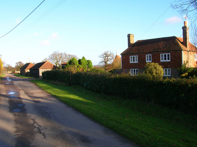
Toll Farmhouse, Toll Lane
Sturdy Wealden farmhouse on Toll Lane which links Prinkle Lane with Bodle Street Road.
 Map © Crown Copyright")
TIP: Click the map for more Large scale mapping
- Grid Square
- TQ6514, 53 images (more nearby 🔍)
- Photographer
- Simon Carey (more nearby)
- Date Taken
- Saturday, 29 December, 2007 (more nearby)
- Submitted
- Saturday, 29 December, 2007
- Subject Location
-
OSGB36:
 TQ 651 143 [100m precision]
WGS84: 50:54.2735N 0:20.8392E - Camera Location
-
OSGB36: TQ 651 142
- View Direction
- East-northeast (about 67 degrees)