2007
NH4962 : Confluence of burns
taken 16 years ago, near to Bottacks, Highland, Scotland
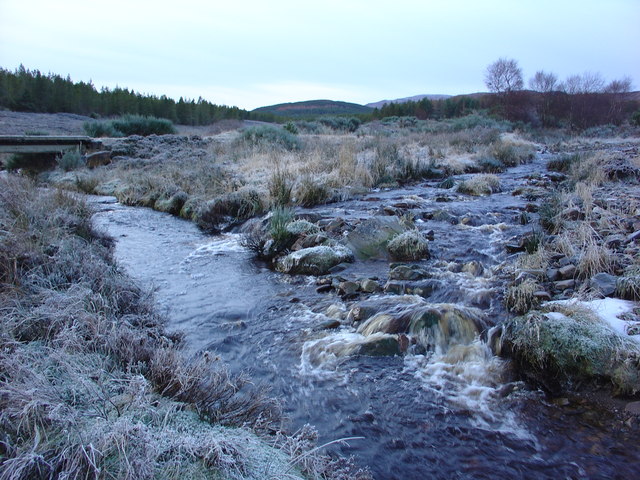
Confluence of burns
The Abhainn Dhubh burn to the right and the un-named burn to the left, meet to form the Abhainn Sgitheach river, which then flows north-eastwards to Evanton. The bridge over the left burn, is part of the forest track from Heights of Keppoch to Rogie, via Glensgaich. The track is used in the Snowman Rally.
 Map © Crown Copyright")
TIP: Click the map for more Large scale mapping
- Grid Square
- NH4962, 10 images (more nearby 🔍)
- Photographer
- Alasdair MacDonald (more nearby)
- Date Taken
- Sunday, 30 December, 2007 (more nearby)
- Submitted
- Sunday, 30 December, 2007
- Subject Location
-
OSGB36:
 NH 492 622 [100m precision]
WGS84: 57:37.4796N 4:31.5565W - Camera Location
-
OSGB36: NH 493 622
- View Direction
- WEST (about 270 degrees)